Friday, August 04, 2006
Flood risk status of Coatham links
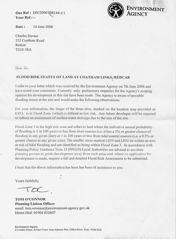
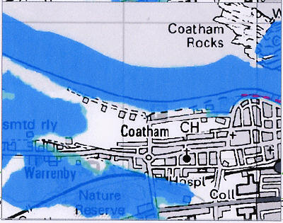
Two images here, one is a lettter from the enviroment agency suggesting that the council should advise against development due to the flood risk. The other is a map of the area showing predicted flooding. Again, click to enlarge.
the text reads:
FLOOD RISK STATUS OF LAND AT COATHAM LINKS,
I refer to your letter which was received by the Environment Agency on
For your information, the larger of the three sites, marked on the location map provided as [ is in Flood Zone I which is defined as low risk. Any future developer will be required to submit an assessment of surface water drainage due to the size of the site.
Flood Zone 3 is the high risk zone and refers to land where the indicative annual probability of flooding is 1 in 100 years or less from river sources (i.e. it has a 1% or greater chance of flooding in any given year) 1 in 200 years or less from tidal/coastal sources (i.e. a 0.5 or greater chance in any given year). The smaller areas marked L839 and L853 lie within an area at risk of tidal flooding and are identified as being within Flood Zone 3. In accordance with Planning Policy Guidance Note 2 (PPG25) Local Authorities are advised to use their planning powers to guide development away from such areas and, where an application for development is made, require a full and detailed Flood Risk Assessment to be submitted.
 I trust that the above information has been has been of assistance to you.
Yours faithfully
TOM O’CONNOR
Planning Liaison Officer
email: tom.oconnor
Direct Dial: 01904 822607
Environment Agency -
Coverdale House,
![]()
